Showing posts with label Galilee. Show all posts

Monday, October 29, 2018

A Dig at Zippori

During my two month visit to Israel, I participated in four archaeological digs, at Gezer, Tel Hadid, Zippori and at Tel Dan. My favorite experience was the work at Zippori.
Arches Reservoir at Zippori
Zippori was the capital city of Galilee in the first century AD. It is located a few miles from Nazareth, and many feel that Joseph the father of Jesus worked on government projects at Zippori.
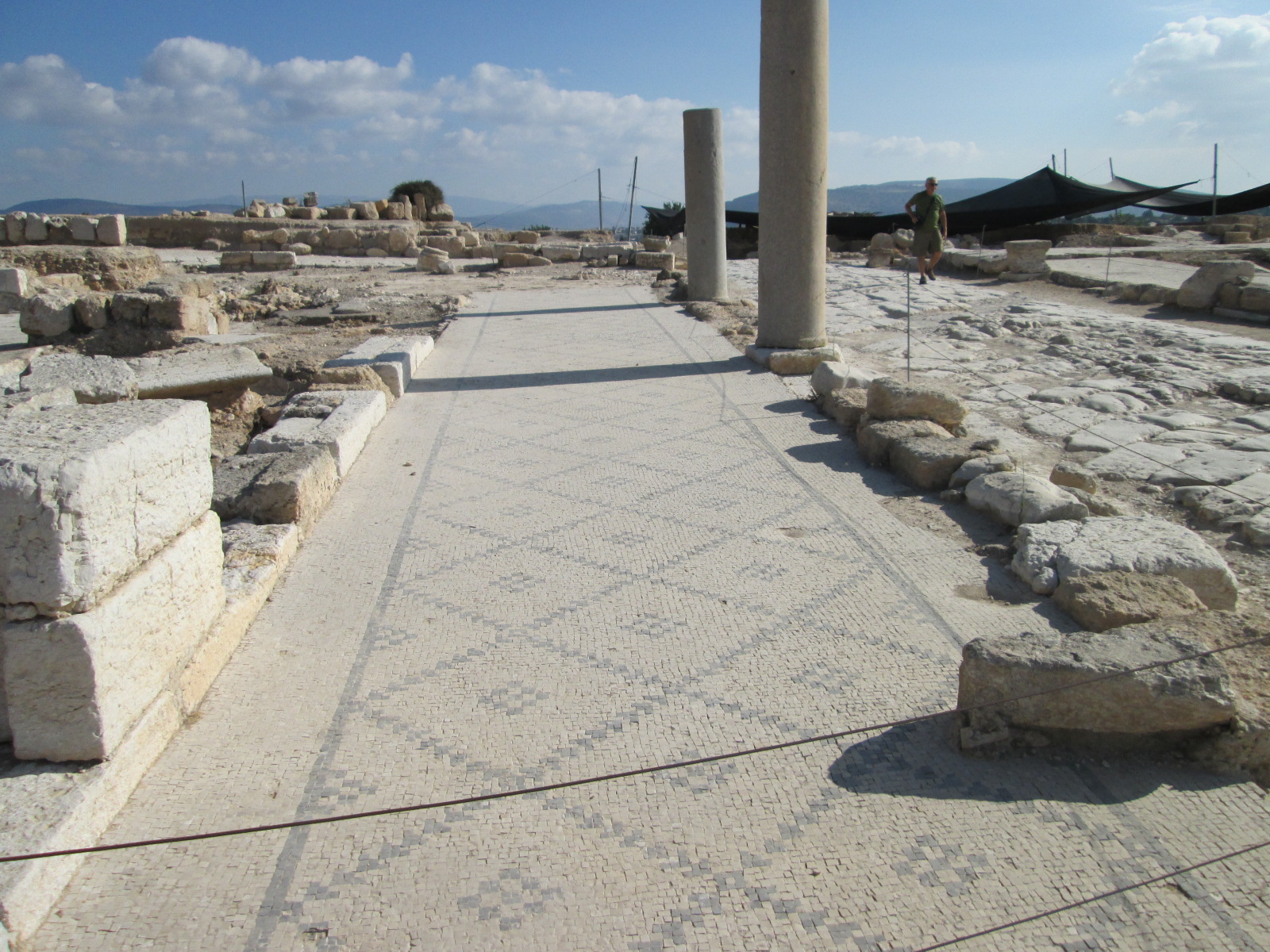
Merchants sidewalk along main street
The cardo of this city is amazing. It is actually two roads that cross each other at the main intersection. Buildings have been recovered along both roads.
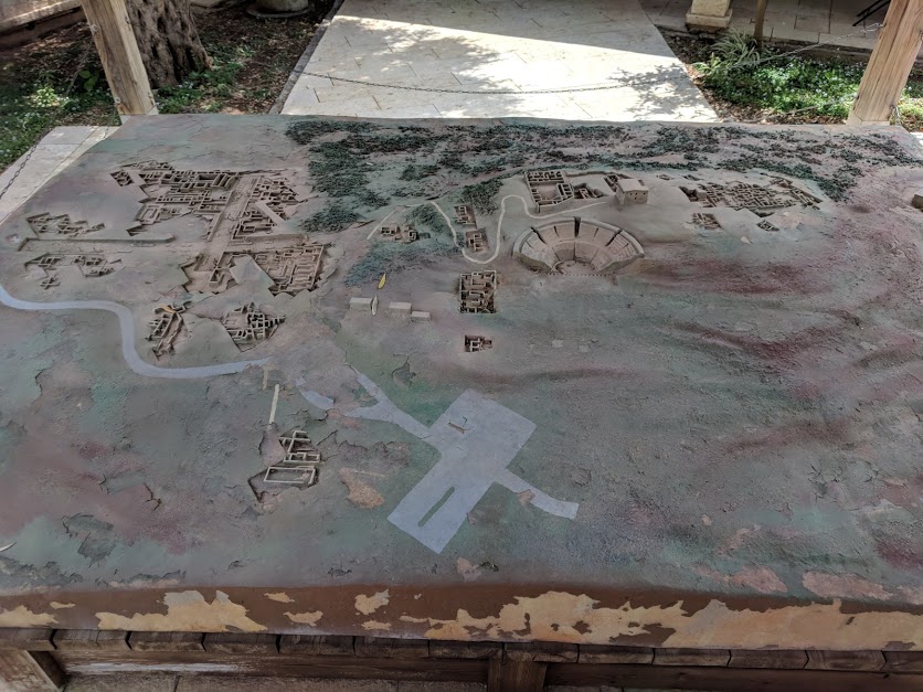
Site map of Zippori
The city also contains amazing mosaics. Some are located in what is called the Nile house.
Centar at the Nile House
Other mosaics can be found at the Dionysus House.
Mona Lisa of Galilee
There is also an amazing mosaic in the Synagogue.
Mosaic on the floor of the Synagogue
We worked at the first century water project. This is a cistern that held water that flowed down hill from spring along the Nazareth ridge.
Nazareth Ridge above Zippori
There are actually two cisterns. The first was untouched since the first century.
Arches Reservoir at Zippori
The second was developed into a wine press.
First view of the Arches Reservoir
Wine was stomped at one end of the cistern
First view of the Arches Reservoir
It flowed into a mikvah that was more than seven feet deep.
Shade tarp over the Arches Reservoir
There was also a stone reception area with pavers.
Measuring the Mikvah
We helped excavate the mikvah area.
Debris and stones above the Mikvah
It started by clearing roofing members which fell. The roof was a system of arches and coverings to keep the water in the dark until it was needed.
Digging Team at Zippori
We hauled lots of dirt out of the system, and also rocks. We found coins, pottery and other items as we dug.
Pottery found during our dig at Zippori
We worked with several archeologists who taught us about the site. They showed us the difference between first and second century plaster, as well as showing us areas of the cistern (structure) that was not plastered.
Filling dirt buckets at Zippori
I have included some stories from the hills of Galilee in my new book, Israel:Stories for Your Journey.
New book on Israel
Some of the places I visited during the two weeks of my tour were places I visited before, but since I helped plan the tour, there were some new places also.

Sunday, June 3, 2018

Climbing Mount Arbel

The mountain of Galilee called Arbel is an amazing place. The mountain, at just under 600’ above sea level on first hearing is a bit anemic, but normal statistical facts are just one way of looking at the mountain. The more impressive number comes as one begins to understand that Mount Arbel overlooks the Sea of Galilee, which is currently 700’ below sea level. This means a climb up the mountain (and the view off the mountain) is about 1,300 feet. Both the view and the climb are worth the effort it takes to reach the top.
The northern view from Mt. Arbel
An ascent up Mount Arbel begins at a trail head between Magdala and Migdal near the intersection of highways 90 and 807. We got off of a bus, but there is probably also a place for cars. The beginning of the trail is a moderate, but continual ascent with very few stairs.
Mount Nital next to Mount Arbel
The trail enters the national park across a cattle guard in an area where bovine are grazing. One web posting said, “If you don’t bother them, they won’t bother you.” The cattle add to the scenic appeal along with wild flowers and various types of plants along the trail.
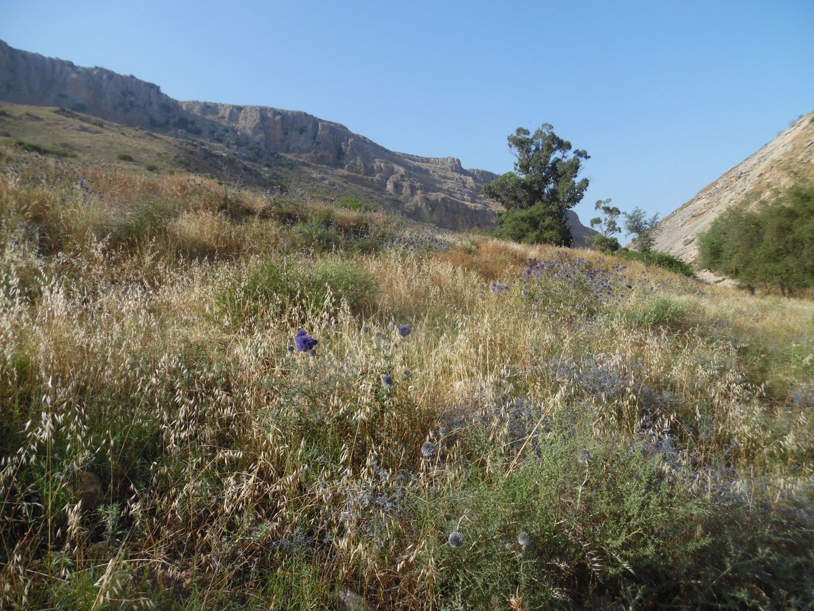
Spring flowers on the trail
The trail ascends between two peaks: Mount Arbel and Mount Nitai (named after a Rabbi of the 2nd Century BC, who is quoted in the Mishnah as saying, “Keep your distance from bad neighbors, ally yourself not with the wicked and do not abandon hope when faced with calamity.”) Notice as you hike the caves on both mountains.
The Horns of Hattin seen from our trail
Rising between the two mountains the hiker will notice the Horns of Hattin, an important battle site where the European Crusaders faced a humiliating defeat to Ayyubid sultan Salah ad-Din, (AKA, Saladin). The actual peak is an old volcano crater.
A stop at the tall rock
The trail ascends to an area with rock outcroppings, which provide seating so the view below can be enjoyed. This is a good time to take a break, because the trail will become steeper beyond this point, and most who take the trail will be ready for a rest. The villages of Migdal, Hamaam, and Ginosar can be seen below. The rest can be short, for the view gets better as one ascends.
Trail signs ... and decisions
The next stop, along an ascent and several steps is at a set of trail markers. At this point it is time to explore some of the nearby caves and to take pictures of the caves on Mount Arbel and Mount Nitai. When it comes time to move on, a choice must be made between two trails. The trail to the left ascends to the top of Arbel with scenic views of the Sea of Galilee. The trail to the right goes through areas of caves towards the visitor center, away from the lake. Both are very beautiful in their own way. The trail along the caves is more difficult.
The Sea of Galilee from Mt. Arbel
The trail to the left crosses many rock outcroppings, contains teps and metal handholds. It ascends between Kinneret and Caro lookouts. The beauty is outstanding. There are many places to sit and enjoy the views, so climbers should not be in a rush to get to the top.
A Cave Dwelling on Mt. Arbel
The cave route gives the climber opportunities to visit the Ottoman Fortress and the caves of Refuge. The caves are interesting because they provided safety zones in times of battle. They were large enough for families and many men to live within, but the arrival pathway was very narrow. Attacking armies were required to travel single file, and could easily be pushed off the mountain upon reaching cave entrances.
Caves on top of caves, a high-rise complex
The caves became hideouts in 161 BCE, when Seleucid commander Bacchides came to fight Judah Maccabee. They were used again in 25 BCE when the people of Galilee resisted a new governor named Herod the Great. They found use again during the great revolts of 70 and 132 AD.
The steep ascent at the top
It could be said that the modern elevator was invented at Arbella. During the revolt of 37 BCE, Governor Herod would not tolerate any resistance, and required his generals to find a way of rooting out the rebels. They finally created a box car which could be lowered from the top of the cliff down to the caves. The car afforded safety railing which prevented soldiers from being shoved off the cliffs.
Reconstructed elevator from 37 BCE

Several Jewish communities existed atop Mount Arbel. Jesus visited the mountain often with his disciples, and it is possible the transfiguration took place at this site.

Wednesday, May 30, 2018

Digging in Zippori

Yesterday, today and tomorrow’s activity involved investigating a first century water system. We are concluding a dig on a cistern in order to determine the flow of water.
Cistern Archaeology Project at Beginning
The town of Tsippori originated in the fourth century BC (or maybe before) on a high hilltop which offered both protection and a great view. The name Tsippori means “Bird,” perhaps, as the Talmud suggests, because it was "perched on the top of a mountain, like a bird.” (Megillah, 6, 81)
Looking across Galilee, as a Bird
The city was very strong, and for this reason it became a regional capital. According to Josephus, Tsippori was called the "glory of the entire Galilee."
Mosaic walkways in the market in Zippori
When Herod's son, Herod Antipas was made tetrarch, he made Sippori the capital of all of Galilee, and began a huge building project.
Mosaic floors from homes in Sepphoris
It might have been at this time the cistern where we are working was created as a resigour along the aqueduct from water sources around the Nazareth Mountains.
Information sign for the Cistern
The population was mixed, but mostly gentiles.
Mosaics from homes in Tsippori
The city is laid out in a typical Roman pattern with wide north-south and east-west cardios. There is a large shopping complex where the main roads cross.
Walking on the old Roman Cardio
The homes in Sepphoris were quite ornate and featured mosaic floors.
Mosaic Mona Lisa of the Galilee
A small Jewish area is located near the top of the hill,
Jewish Neighborhood in Zippori
It features mikvah pools, which tell of its Jewish character.
Looking at a Mikvah Pool
The Sanhedrin met here for a time after the destruction of the Temple.
Bird's Eye View of Jewish Neighborhood, Mount Carmel in background
Rabbi Yehuda Hanassi transferred the seat of the Sanhedrin from Bet She'arim to Tsippori, and around 220 CE he completed the Mishna in the city.
Synagogue Mosaic
The Synagogue of the city saw several renovations over the years. The mosaic floor of the fifth century Synagogue is enclosed with a multimedia presentation. It contains scenes from Bible stories, priestly offerings and a zodiac diagram.
Cistern Project this evening, compare for progress
Our work on the water cistern has made huge strides in the past few days.
Tour Group from Georgia that helped us dig
We have found pottery, old nails, roof tiles, some Roman glass, and old coins.
One of the coins found at Tsippori

The archaeological dig was productive and enjoyable.

Friday, August 25, 2017

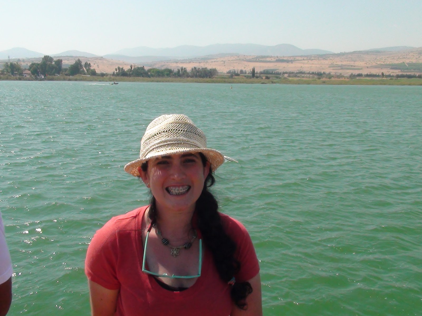
The Sea of Galilee

A voyage on the Sea of Galilee will be one of the activities during our 14 day trip to the Holy Land in May 2018. This body of water, also known as Lake Kinneret, Sea of Ginosar, or Lake Tiberias is a large freshwater body which was gone out upon frequently by Jesus and his disciples. Lake Kinneret was an oasis along a route used by ancient travelers through the land. An excursion on the Sea of Galilee is a highlight for many travelers to Israel.
The Sea of Galilee from Ginosar
The Sea of Galilee is a very wide spot in the Jordan River basin.  The river enters on the north side of the Sea near Bethsaida and exits on the south side of the sea near Kinneret. Within the pool of Tiberias, the collected water is 13 miles long and 8 miles wide. The level of the water sits at 700 feet below sea level, with a water depth which reaches 140 feet. The basin is made largely of basalt rock which can be picked up from the bottom as smooth stones.
The Sea of Galilee from Maagan Holiday Village
Lake Kinneret sits along the main trade route from Mesopotamia to Egypt. Caravans would have traveled along the Euphrates river, across the desert near Damascus, down the Hula Valley, and through Galilee to the Horns of Hattin and the Jezreel Valley. Settlement in the area has existed since prehistoric times with the archeological site of Ohalo at the southern end of the lake being called “one of the best preserved hunter-gatherer archaeological sites of the Last Glacial Maximum.
The Sea of Galilee from the East
During New Testament times, the Sea of Galilee was known for its fishing industry. Josephus records that as many as 230 fishing vessels sailed on the lake daily. We know the names of several fishermen from the New Testament including Peter, James, John, Andrew, and Zebedee. They caught a variety of fish including Musht, Biny, and Sardine.4
The Jesus Boat at Ginosar
On our trip we will visit the museum at Kibbutz Ginosar, where we will see “the Jesus Boat,” a fishing vessel which dates to the time of Jesus. This boat, made from twelve types of wood, is in good condition for its age. We will watch a video detailing its recovery and see the site where this boat was found.
The Jesus Boat at Ginosar
During our voyage on the Sea of Galilee, we will become acquainted with the surrounding villages as seen from the sea. We will enjoy watching windsurfing and other sailing endeavors from our boat. We will hear about the storms often stirred up because of the unique geography of the region and we will be told the story of how Jesus calmed the sea.
Looking north from a boat on the Sea of Galilee
The journey on the Sea of Galilee will help us visualize where a major portion of the Gospels took place. Throughout this journey we will not only walk where Jesus walked, but we will also ride a boat atop the lake where he often sailed. To find out more about the trip, click this link. To sign up for the trip click here. I hope you will travel with us during our 14 day trip to the Holy Land in May 2018.

Friday, August 18, 2017

Capernaum

In May 2018 I will be taking a group on a 14 day trip to the Holy Land. During this trip we will visit the Galilee region and Capernaum, a city where Jesus lived for several years. This city on the shores of the Sea of Galilee is an interesting place to visit. The site is maintained by the Franciscans, who have added walkways and benches and maintained the landscape so the story of Jesus’ residence can be told without too many modern intrusions.
Gate at the Franciscan Monastery of Capernaum
During our visit to Capernaum, we will enter the archaeological site through gates situated by a Catholic church. Once on the property we will be seated on shaded benches where our tour leaders will explain what can be seen at the site and share associated Bible stories so we can take away a memorable experience.
Shade trees which protect seating area of Capernaum
From the benches we will be directed into a fourth century synagogue constructed from imported limestone. Limestone was chosen for the exterior of the Synagogue to give a white (pure) appearance in a village constructed mostly out of the black basalt rock, which was easily available in the region. The fourth century building is well-maintained and enables the visitor to walk within and understand construction and practices in ancient places of worship. Tall pillars and an intact anterior provide photo opportunities and an ambiance to the visit.
Anterior of the Capernaum Synagogue
On the south side of the Synagogue, a portion of the earlier basalt synagogue has been uncovered where visitors are able to see a portion of the building in which Jesus and the disciples worshipped.
Remains of a first century synagogue at Capernaum
Outside the Synagogue, we will walk through a large area of foundational ruins. Many of the foundations are several feet in height and display steps and other features which will help us visualize the city Jesus called home (Matthew 9:1)
Ruins of Capernaum from the Synagogue
Over one area of ruins we will be able to enter a twentieth century church which sits above a residence believed to be the home of Peter’s mother-in-law. The modern church has a glass floor which allows visitors to see foundations of a first century home and a fifth century church. Diagrams give explanation of the existing foundations.
Looking across ruins of Capernaum to the new octagonal church
Beyond the ruins we will be able to walk down to the Sea of Galilee. We will visualize the beaches from which Peter, Andrew, James, and John departed on their fishing excursions. These shores are also the place recorded in Matthew 4 where Jesus meets Peter and says, “Come, follow Me, and I will make you fishers of men.”
Looking from Capernaum across the Sea of Galilee
On our trip within Galilee we will see Capernaum from several different vantage points. We will see the village from our boat ride on the Sea of Galilee, from the top of Mount Arbel, and if we strain our eyes from Kibbutz Ma’agan, where we will spend three nights. Once we walk through the village of Capernaum in Galilee, each sighting will give us a new perspective as we discover the shores along which Jesus often walked.
A view of Capernaum from the top of Mt. Arbel
If you would like to join us on our 14 day trip to the Holy Land click this link. To sign up for the trip click here. I hope you will travel with us during our 14 day trip to the Holy Land in May 2018.