Showing posts with label Guvrin. Show all posts

Monday, May 7, 2018

The Shfela

Today’s journey took us through the Shfela, or the low foothills between the Via Maris (way of the sea) and the Judean highlands. This would be similar to the foothills leading up to the mountains in North Carolina. All roads leading up to the interior highlands follow streams and valleys. Strong walled cities guard the entrance to each valley in order to control the travel corridor.
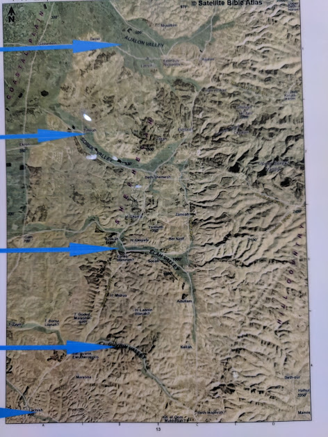
Five Valleys in Israel
The five valleys from north to south are the Ayalon, Sorek, Elah, Guvrin and Lachish valleys. The map above will show these clearly.
The Canaanite section of Tel Gezer
Our first stop of the day was at Tel Gezer, a site we are familiar with because Sarah participated in the dig for two years. (Video). Tel Gezer has a long history, with more than twenty levels within the tel. Gezer controls the Ayalon Valley. Excavations include a Middle Bronze period gate and water tunnel, and also a portion of the city from Solomonic times, when Pharaoh of Egypt gave the city to his daughter and his new son-in-law Solomon.
The Solomonic Gate at Gezer
From Gezer we traveled to Beit Shemesh in the Sorek Valley. This was the area where Samson lived. It is also the place where God returned the Ark of the Covenant to Israel after its capture by the Philistines. There is a new archeological dig at this site.
New Digs at Beit Shemesh
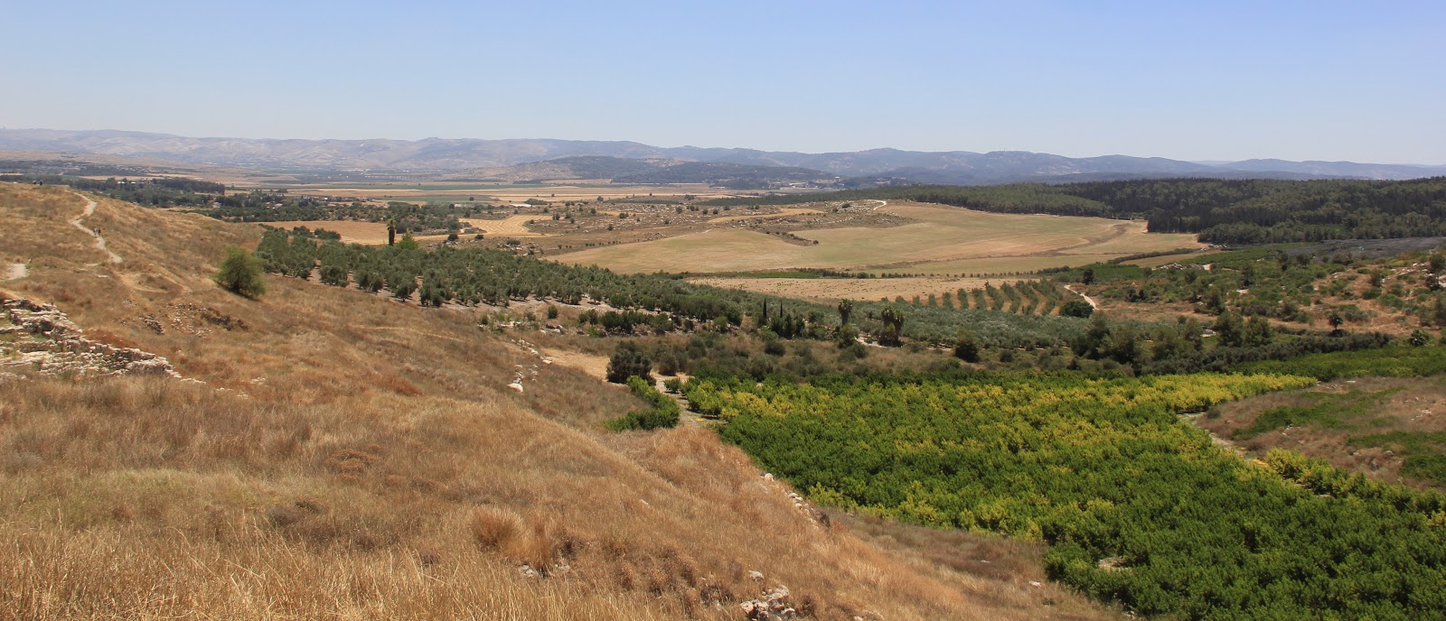
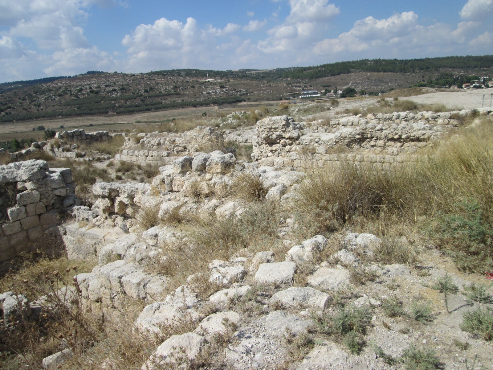
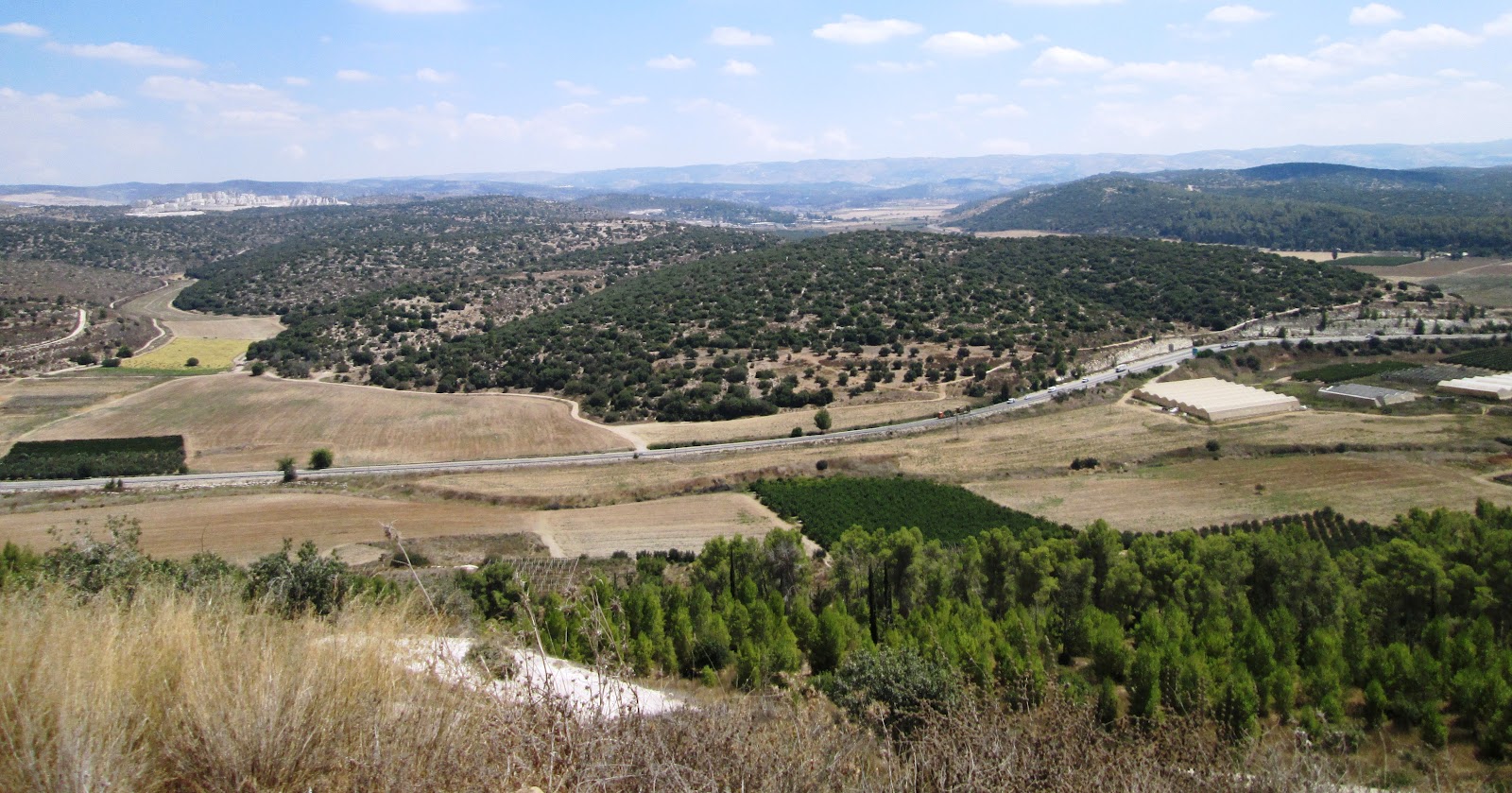
We then visited the Elah Valley, where a boy named David fought the giant Goliath. We were able to get a good view of the valley from Shaaraim or Shaaraim, a city with two gates which dates to the time period of King David. Our guide laid out the entire battle plan so we could see exactly where events took place.

Shaaraim, a village of Two Gates
We visited Gath, the city protecting the Elah Valley. This city is also the hometown of Goliath. It is a massive tel with a long history.
The Philistine Village of Gath
Our journey continued with a stop at Beit Guvrin, this is were King Herod grew up. There are multiple columbarium (caves for doves) that are carved out of the chalk to produce underground caves.
Dove Housing at Beit Guvrin
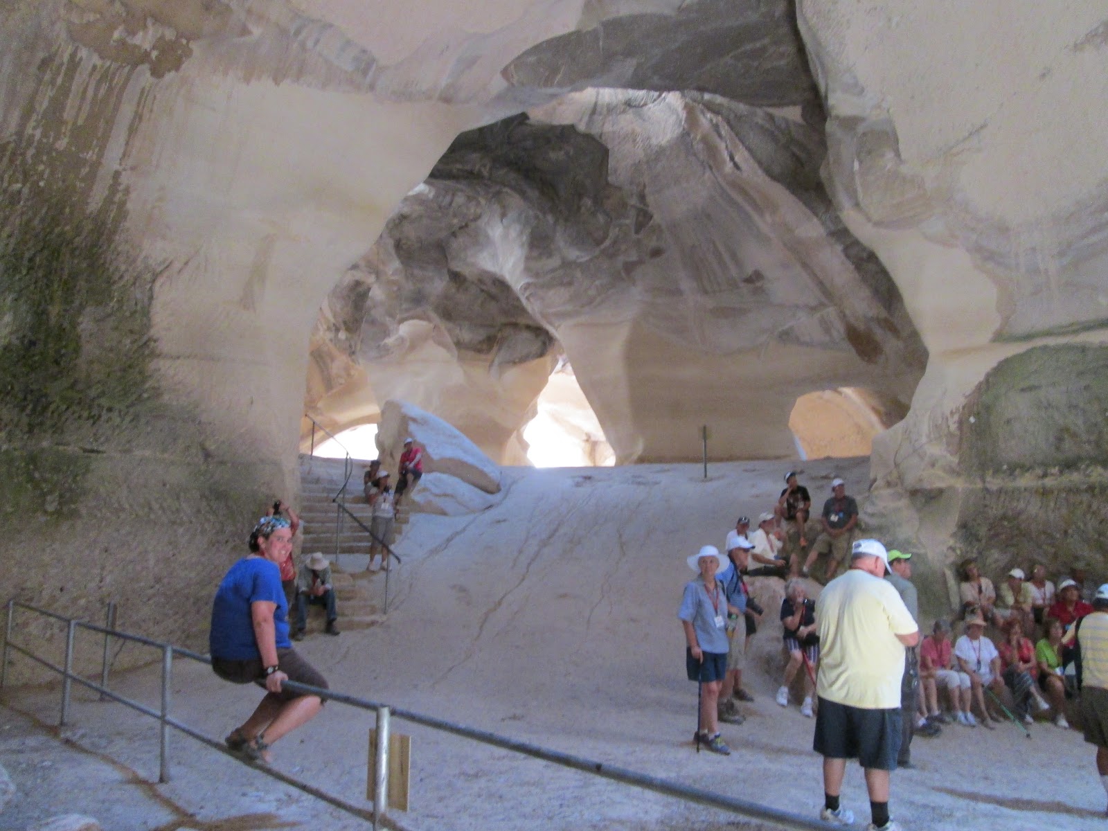
There are also massive caves left behind from the mining of chalk. These bell shaped caves are very beautiful and have great acoustics.
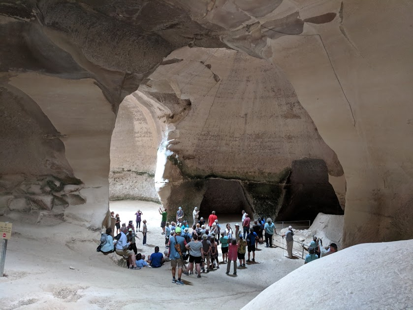
The Bell Caves at Maresha

We finished the day at the motel in Beer-Sheva.

Wednesday, March 22, 2017

Maresha and Bell Caves

The land of Israel is filled with natural beauty. One of the sites we will visit on our 14 day trip to the Holy Land in May 2018 are the bell caves at Bet Govrin. These huge caves are the result of underground quarries during the Byzantine and early Muslim periods. Over the years erosion has created bell shaped interiors with walls from the chalk compound that makes up the caves.
The Bell Caves are located near the older town of Maresha built by Rehoboam (2 Chronicles 11:5-8). The area was attacked by Egyptian Pharaohs Shishak and Osorkon. The Madaba Map records Maresha as the home of Micah the prophet.
After the assault by Nebuchadnezzar Edomites moved into abandoned cities in the region. The region became known by the Greek term Idumenea. John Hyrcanus conquered the region in 112 BC and forced Judaism upon the residents.  King Herod the Great, who was a son of a converted Idumaean consolidated power and showed favor to Maresha.
During the New Testament era Maresha was able to capitalize on its relationship with King Herod and his relationship with the High Priests of the Temple, especially his relationship with Simon Boethrus. Dove columbarium caves were excavated and raising these birds for food and Temple sacrifice became a major industry. The columbariums are filled with thousands of roosts so the birds can rest inside and find food outside. We will walk through a large roosting cave while we are on our trip to the Holy Land.
Bet Guvrin-Maresha National Park is filled with history and interesting sights. In addition to the Bell Caves and Columbarium Cave there are olive press caves, bathtub caves, Sidonian caves, and a Maze Cave from the Hellenistic period. Caves have been carved and used in the region from prehistoric times to the present. Caves were used as a hiding place for troops commanded by Polish General Wladslav Anders during World War II. There are many ancient housing areas including Tel Maresha, Eleutheropolis and Bet Guvrin. Kibbutz Bet Guvrin is located just outside the National Park.
Maresha is in the Judean Hills and the Shephelah region of Israel. It is in the Guvrin Valley at its intersection with what is known as the Parallel Road.  Guvrin Valley, also known as Wady el-`Afranj leads from Ashdod to Hebron.

As we travel through the hill country and through the various valleys we will gain an understanding of this region’s importance in both Biblical and modern eras.

Wednesday, March 8, 2017

The Shephlah

We will spend the third day of our 14 day trip to the Holy Land in May 2018 in the shephelah, a series of low hills which connects the coast of Israel to the Judean Highlands. This region contains important transportation hubs and has been one of the most hotly contested regions in Israel.
A map of the Shephiah region of Israel
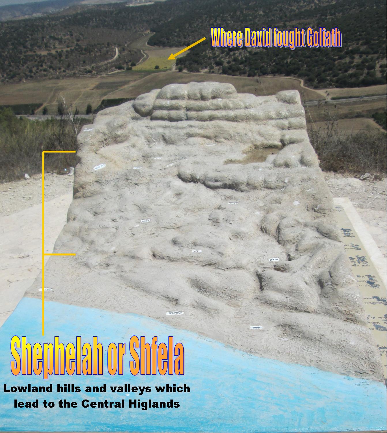
The word  שְׁפֵלָה, Shephlah, sephela, saphela or shefla comes from the word low, and thus indicates low or sinking lands. This unique landform exists from the east of Tel Aviv and the Plain of Sharon and ends north of the Negev. The Shephlah rises from the coastal plain to the Judean highlands. The rumpled land of this area contains low hills and valleys between the hills.
Model of the Shfela in Elah Valley where David defeated Goliath
Throughout the history of the promised land people have traversed the valleys in order to reach the central highlands. Today the roads of Israel continue to follow the Ayalon Valley, Sorek Valley, Elah Valley, Beth Gurvin Valley and the Lachish Valley. We will visit sites in each of the five major routes on our the third day of our 14 day trip to the Holy Land.
Tel Gezer in Israel
At the head of each of the valleys there is a high hill upon which a fortified city has been built. At the head of the Ayalon Valley this is the city of Gezer. At the top of the road are the towns of Yalu and Emmaus. The road runs from Jaffa across the coastal plain, up the Ayalon Valley and the Beit Horon ascent to Jerusalem. The route is still popular today with Israel Highway 1 using this route from Jerusalem past Ben Gurion Airport to Jaffa.
Monoliths at Tel Gezer
The Ayalon Valley is a place of much history. This is the place where the sun stood still during Joshua’s conquest of the land. The Amarna letters written to Pharaohs Akhenaten and Tutankhamun menton the town of Ayalon. Pharaoh Sheshonk I attacked the Amorites in this area in the 10th century BC. King Saul and the Maccabees also fought in this valley. The state of Israel fought several major battles for the Ayalon Valley in the twentieth century.
Beit Shemesh where the Ark was returned to Israel
The Sorek Valley extends from Ekron on the coastal plain to Eshtol at the top of the valley. The town of Beit Shemesh (recorded in 1 Samuel 6) is in at a junction where the valley narrows. The Sorek Valley was home to Samson and Delilah. The main road to Jerusalem ran through this valley in the early nineteenth century. The railroad from Jaffa to Jerusalem still runs through the Sorek Valley.
The place where David fought Goliath
The Elah or terebinth Valley is a known for its many oak trees and great fertility. The lower end of the valley is protected by the fortress town of Gath, which is also the hometown of Goliath. The valley runs past Azekah and Socoh to Adullam. David fought Goliath in this valley, picking up five smooth stones from Elah creek. We will visit Khirbet Qeiyafa while in visiting Elah Valley.
Inside the Bell Caves
The Guvrin Valley leading from Gaza to Hebron was one of the region's most important trade routes. Joshua fought many battles in this valley, King Rehoboam made Maresha into a fortress and later Micah the prophet preached in the area. After Israel fell to Nebuchadnezzar many Edomites migrated to Guvrin Valley and made it a second homeland which was later called Idumea. King Herod of the New Testament ties to this region.
View from the top of Tel Lackish 
Lachish sits to the south of the Gurvin Valley and protects a secondary road from Gaza througt the Shephlah. The city was a major communication center which served as a beacon which sent signals to Azekah and other hilltop locations. Because of its importance it was made into a royal city for Rehoboam and was later conquered by Nebuchadnezzar on his way to Jerusalem.
Please join us on a tour of Israel in May 2018

On a tour of Israel in May 2018 we will take a day to experience sites within the Shephliah and tell stories out of Israel’s past. Please take time to sign up to travel with us.